Survey and Layout of Gonzales (1827)
The first geographic site of Gonzales emerged in 1825 with cabins established along Kerr’s Creek. These were abandoned in 1826 in favor of Old Station and the fort constructed by Byrd Lockhart on the Guadalupe River, where settlers returned in 1827. While these early settlements marked the area’s beginnings, the formal establishment of Gonzales as a town followed Mexican colonization strategies. According to Mexican colonization law, once a colony reached 40 families, a town should be formally established as a cultural and economic center from four leagues of land set aside for the purpose.
James Kerr conducted a preliminary survey in 1825, naming the settlement after Governor Rafael Gonzales. However, this survey did not adhere to the legal specifications. The town’s official establishment began in April 1831, when Land Commissioner Navarro and surveyor Byrd Lockhart laid out the town following precise instructions from Ramón Músquiz, the jefe político of Béxar Province.
Lockhart meticulously followed the legal guidelines, creating a layout of plazas and 42 blocks, each containing six lots measuring 45 by 166 feet. These formed the inner town, situated in the southwestern corner of the four leagues. Seven blocks were designated as plazas for public use, arranged in a cross formation, with the long axis running east to west.
- Market Plaza: Initially located near the river on the west end.
- Cemetery Square: Situated on the eastern edge along what is now College Street.
- Central Plaza: The town’s focal point, flanked by Church Square to the east and Municipal Square to the west.
- Jail and Military Squares: Positioned north and south of the Central Plaza, respectively.
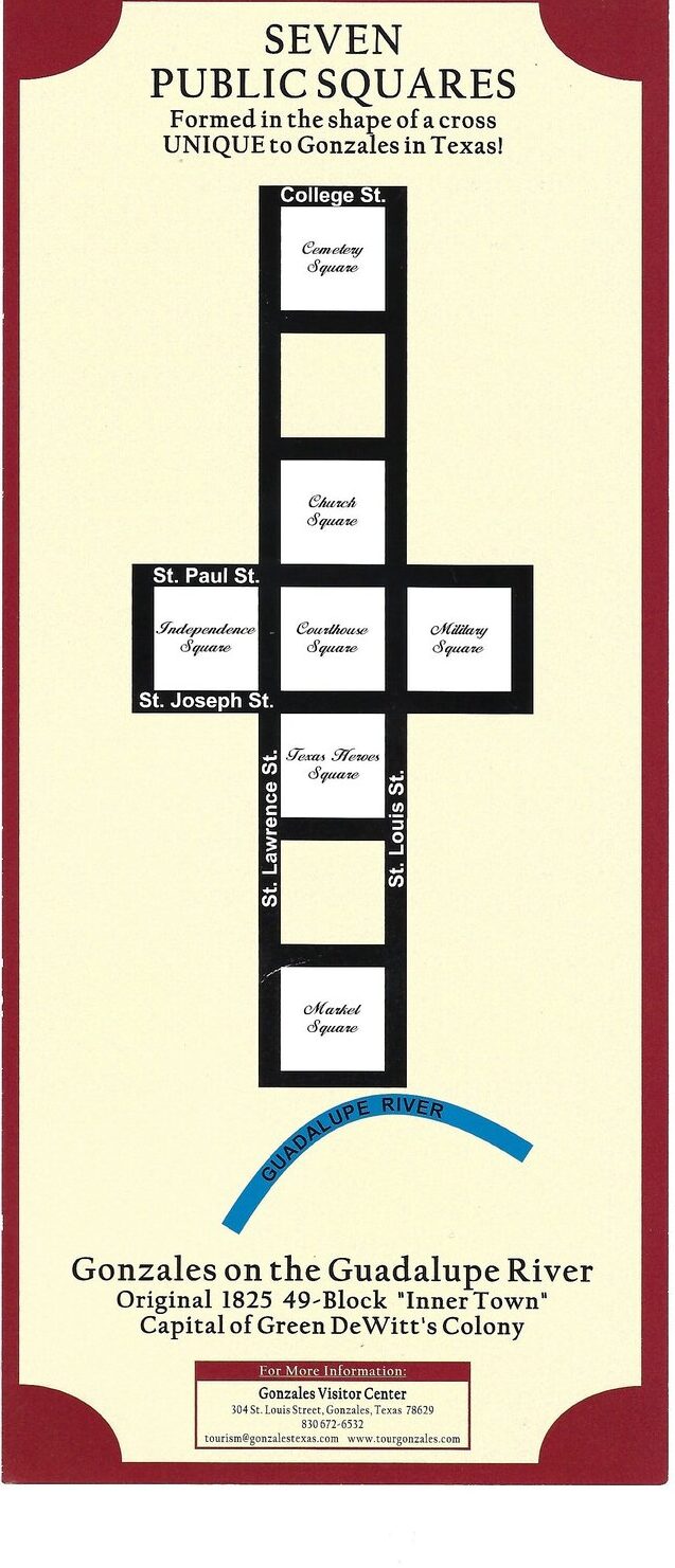
Image portrayal of the Seven Public Squares, with 7 plazas/blocks up and down, and three across in the middle of the 7 vertical stacked blocks
Although Market and Jail Squares reversed their intended roles early on, the town’s layout has largely remained true to Lockhart’s 1831 survey. Streets in the grid, except for Water Street, were named for saints.
Outer town lots, located within the remaining four leagues, varied in size and were auctioned with installment payments. Proceeds from these sales, along with an annual tax of one peso, funded the construction of public buildings, including the church, and supported town operations.
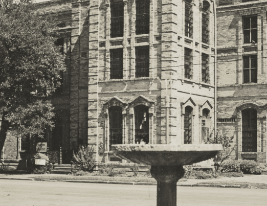
By March 1836, just before the town’s destruction by fire following the Alamo defeat, the inner town comprised 32 buildings, 20 of which had been constructed by 1831. This foundational survey and layout remain the basis for Gonzales today, reflecting its early vision as a center for community and commerce.